Going from analog to digital
Your digitizing PUCK or CURSOR...
EMITS an electrical or light signal when you push one of its buttons
Your digitizing TABLET...
has conductors or sensors that RECEIVE the signal from the puck and convert these to relative tablet positions
Major form of inputting data to a GIS
Takes your map and literally makes it digitial - captures geographic coordinates
Class Notes, pages 19-38
Go into Arc/INFO, turn on digitizer, and run DIGTEST command
Definitions: ARC, NODE, VERTEX, etc.
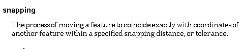
SNAP Distance - sets minimum distance between NODES before their locations are snapped together to coincide
We will use paper but mylar is best because it doesnt shrink or warp
Mark begin/end point on donut polygons
Mark label points in centers of polygons
Mark nodes every 3-4 in. on longer curvy lines - makes correcting errors easier
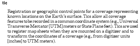
Mark clearly and number TICS
Digitize 2 BNDs
"0" to locate
"1" to digitize vertex
"2" to digitize node
Class Notes pages 19-64 will be helpful
Additional Notes on web page, including a rendition of the Digitizing Blues
Use PARCELS map handout
Follow instructions on Exercise 3 VERY CAREFULLY!!!
Mark tic points, label points, nodes
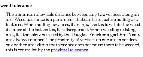
WEED Tolerance - sets minimum distance between VERTICES when digitizing
weeds out vertices within this tolerance or distance
SNAP Distance - sets minimum distance between NODES before their locations are snapped together to coincide
Fuzzy tolerance - minimum distance between vertices in terms of resolution of coverage (commonly 0.0002-0.0004) - also defines how far aprat vertices can be moved during the CLEAN process
Try snap distance of 0.1, weed distance of .25
Mount map on digitizer (may need tape)
Start ADS program in Arc/INFO
ADS ZONES
Digitize 4 TICS
Digitize 2 BNDs
See pages 41-52 in "Class Notes" and additional web notes below
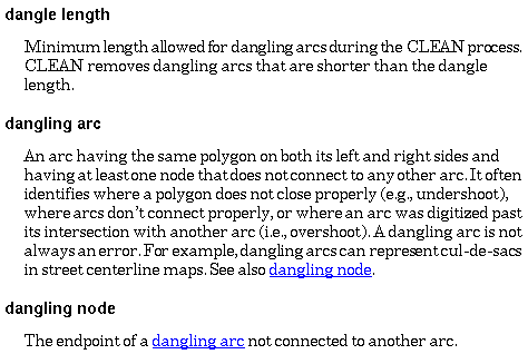
Overshoots - dangling arcs and nodes
Undershoots - node and arc need to be extended
Displayed in ADS or EDITPLOT as square symbols
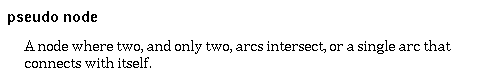
Pseudonodes - single arc connects with itself or node that splits an arc that should not be split
Displayed in ADS or EDITPLOT as squares
Redigitize! Arrghh!
Use ARCEDIT module: tips on backside of PARCELS map handout and also on web page
http://dusk.geo.orst.edu/arc/265_3.html