Here is an example of an excellent poster.
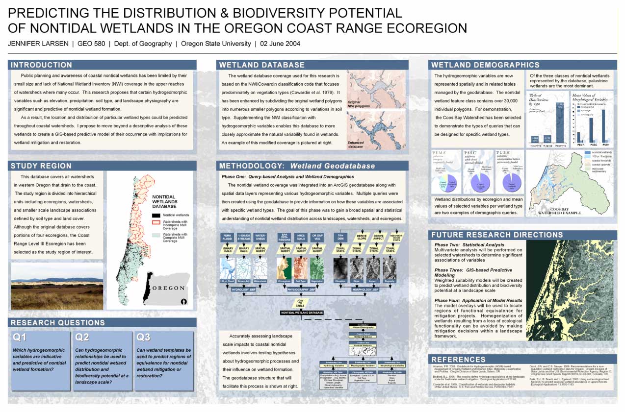
(Click on image for full size)
This is just one example of how you might organize your
material: be innovative! Every poster or web site must include an Introduction, Methods,
and Discussion/Results, along with your name and department and the words "GEO 580, Advanced GIS". The
Methods section of your poster or web site will need to be particulary succinct.
Perhaps all you will need for that section is a flow chart.
Here is a great page on how to make a good poster (www.aspb.org/education/poster.cfm)
And some tips on making great posters in PowerPoint (www.wfubmc.edu/biomed/tipsheets/ppt_poster.html) or (meeting.apsnet.org/callpapers/Powerpoint_posters.cfm)
For on-campus students, since we have access to an excellent 36" plotter, you will probably find it much easier to create the entire poster as one document in PowerPoint, Freehand, or some other package, and send your poster document to that plotter.
Please remember that you can also do your project as a web site instead of a paper poster.
Need help with web page creation? Have no fear, click here!
(http://dusk.geo.orst.edu/gis/page_help.html)
At some point, you should consider developing your own
home page, if you haven't done so already, that includes links to your
resume/CV and your GEO 580 project. Home page
design and creation is not only TONS of fun, but potential
employers or major professors may be favorably impressed with a well-designed
page that demonstrates your skills and talents.
- Why you selected the topic you did and what your main question or hypothesis is. Can the results be quantified? If so, how and by what measures? An indication that you have read the appropriate literature and carefully thought out your analyses must be clearly evident in your paper. You should also take the knowledge and skills derived from class lectures and associated readings (perhaps also from the ArcGIS exercises), and expand upon these in your project.
- How you collected your data (already available? what formats, projections, precisions/accuriacies. Did you obtain or create applicable metadata?
- How you processed your data (conversion to GIS format? importing? projecting or reprojecting?)
- Steps taken in your GIS analysis (or planned steps). This MUST include a flow chart of the GIS analysis steps! An ArcGIS ModelBuilder diagram is an excellent example of a flow chart that should be included. This is essentially your GIS analysis model.
- A general discussion of your findings and a summary or conclusion. What is the answer to your question or your final decision and why? What future steps need to be taken? Where do you need to go from here.
Please include a title page, abstract, full list of references, and appropriate figures and/or tables. Please turn this paper in to me right after you give your oral presentation in class (i.e., have it done and ready to turn in before class that evening that you are presenting). You can also save a tree and email it to me right before class as an MS-Word attachment, which is actually preferred because then I can use MS-Word Track Changes to directly insert comments and return to you..