"It's not easy to lie with maps, it's essential...to present a useful and truthful picture, an accurate map must tell white lies." -- Mark Monmonier
distort 3-D world into 2-D abstraction
characterize most important aspects of spatial reality
portray abstractions (e.g., gradients, contours) as distinct spatial objects
want to differentiate best guesses from truth
- tells where an estimate is likely to be the most accurate
- way of tracking error propagation
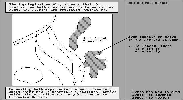
Search For Soil 2 & Forest 5
How Good Given Uncertainty in Input Layers?
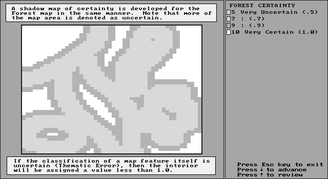
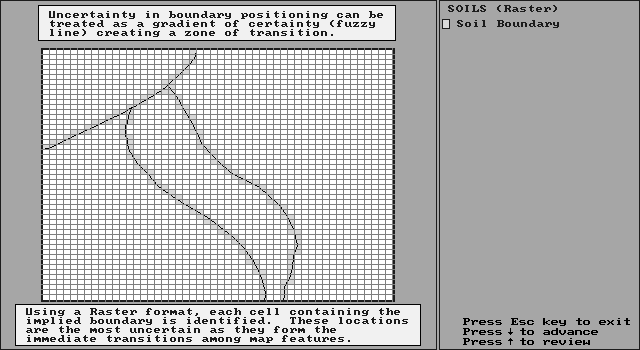
Spread boundary locations to a specified distance:
Zone of transition, Cells
on line are uncertain
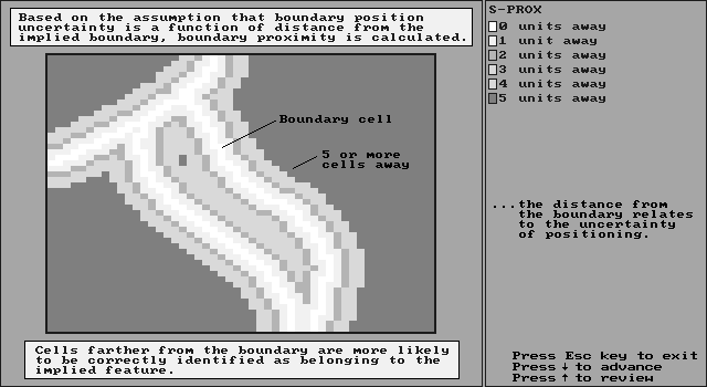
Code cells according to distance from boundary, which relates to uncertainty
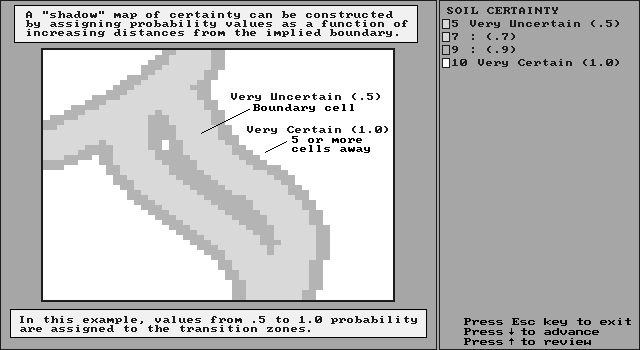
Based on distance from boundary, code cells with probability of correct classification
Overlay soil & forest shadow maps to get joint probability map:
Product of separate probabilities
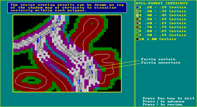
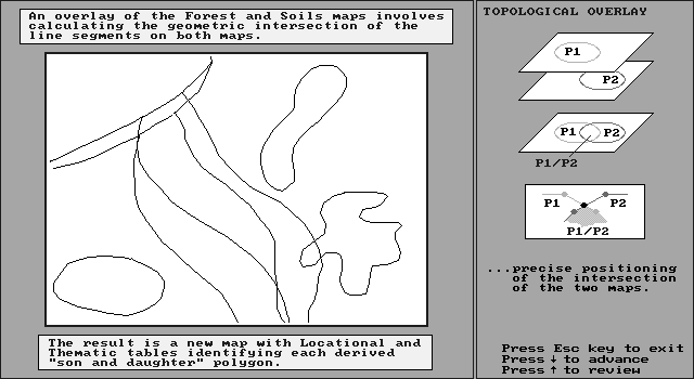
Original overlay of S2/F5:
Overlay implied 100% certainty
Shadow map says differently!
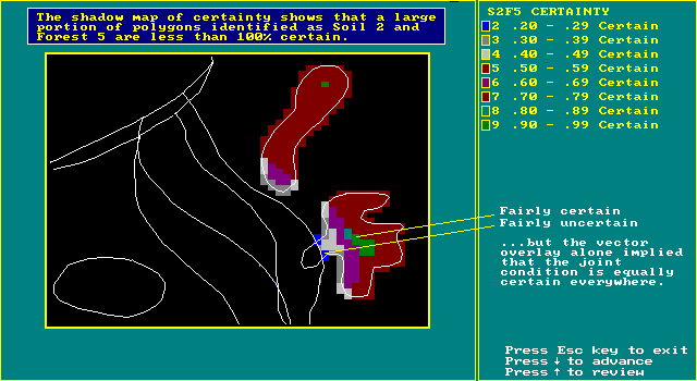
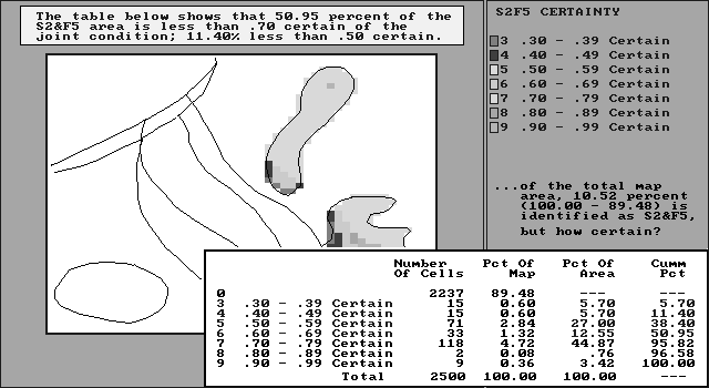
Nearly HALF the map is fairly uncertain
of the joint condition of S2/F5
can also map a continuum of certainty
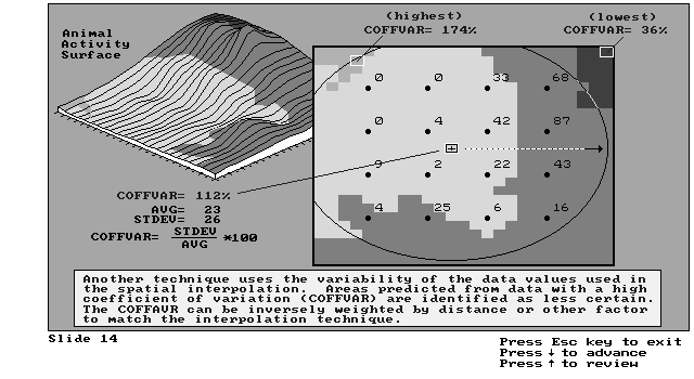
model of the propagation of error (when maps are combined)assessing error on continuous surfaces
- verify performance of interpolation scheme
cart (GIS) in front of horse (spatial statistics)
still, honest maps should and will become more commonplace