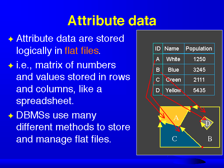
DBMSs use many different methods to store and manage flat files
Every cell has a value, even if it is missing.
A cell can hold a number or an index value standing for an attribute
A cell has a resolution, given as the cell size in ground units.
nearby things tend to be more similar than distant things
data entered as pairs
run length & value
40 items instead of 70
Good for representing continuous surfaces.
Rasters are a natural for scanned or remotely sensed data
Rasters are easy to understand, easy to read and write, and easy to draw on the screen.
Spatial analytical operations are faster
Compression is easier using techniques such as Run Length Encoding and quadtrees
Points and lines in raster format have to move to a cell center
Lines can become fat. Areas may need separately coded edges
Good only at very localized topology, and weak otherwise
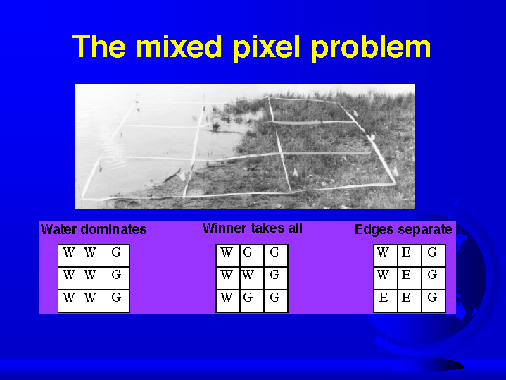
Suffer from the mixed pixel problem
Must often include redundant or missing data
Each cell can be owned by only one feature
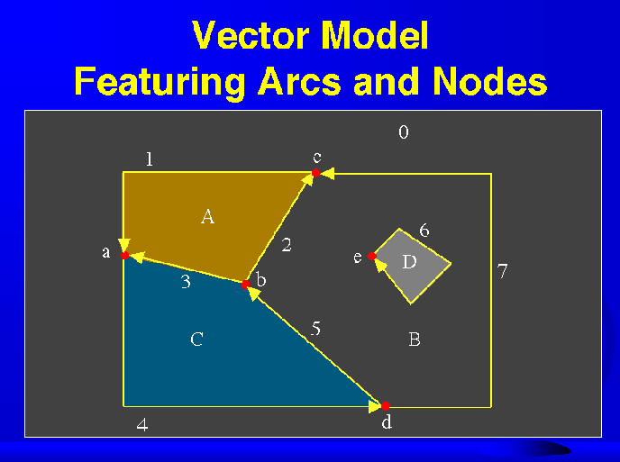
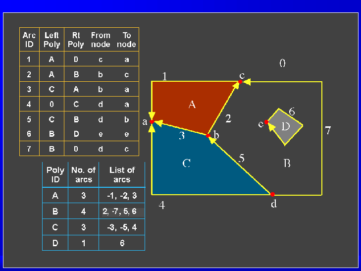
Lines are built from sequences of points in order.
Lines have a direction according to the ordering of the points.
Polygons can be built from points or lines.
Object data model gave rise to the arc/node data structure in the 1960s
The endpoint of a line (arc) is called a node. Arc junctions are only at nodes
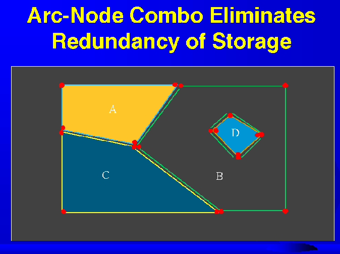
Points, lines, and areas can each be stored in their own files, with links between them
Stored with the arc is the topology (i.e. the connecting arcs and left and right polygons)
Relationships are computed and stored
Rarely are maps topologically clean when digitized or imported
A GIS has to be able to BUILD topology from unconnected arcs
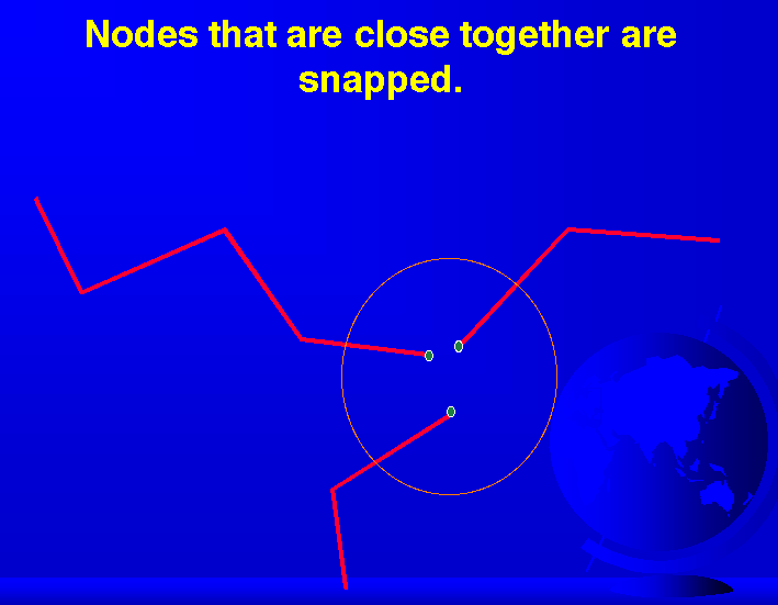
The tolerances controlling snapping, elimination, and merging must be considered carefully, because they can move features
Complete topology makes map overlay feasible
Topology allows many GIS operations to be done without accessing the point files
Topology makes spatial analysis possible
Vectors are far more efficient than grids
Vectors work well with pen and light-plotting devices and tablet digitizers
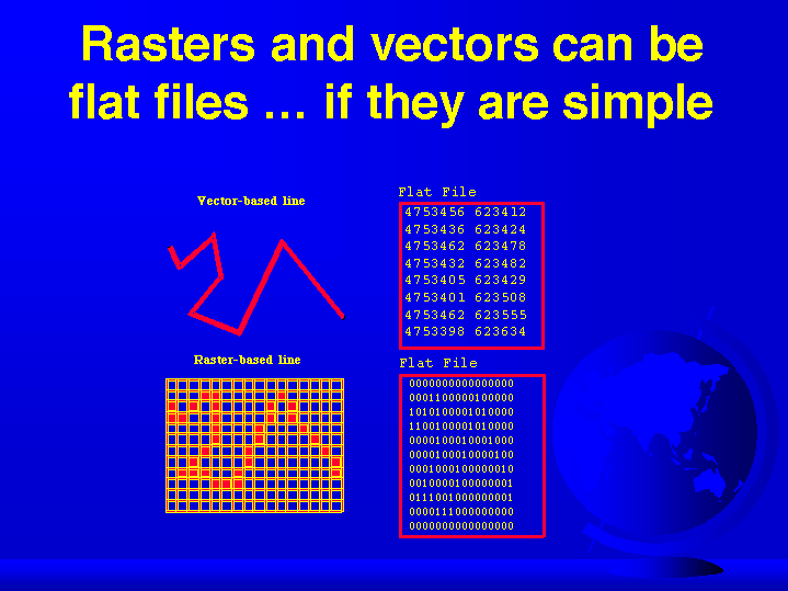
Rasters and vectors can be flat files ... if they are simple - GRAPHIC
A field data model uses a grid data structure.
One grid cell is one unit or holds one attribute.
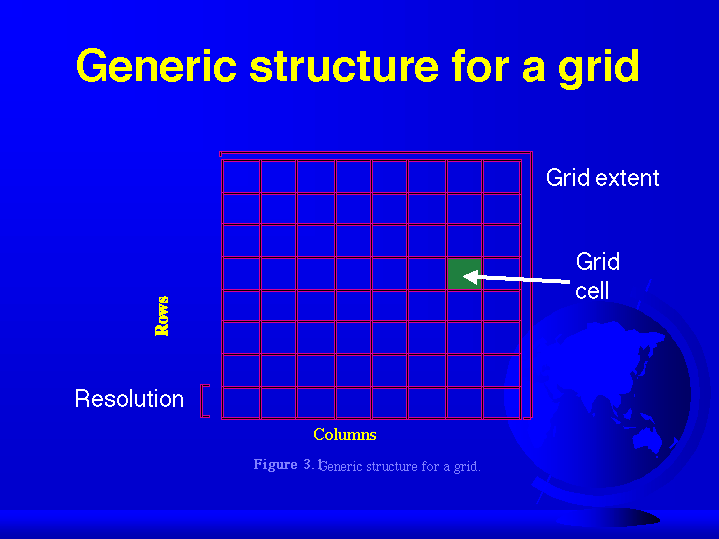
Generic structure for a grid - GRAPHIC
The mixed pixel problem - GRAPHIC
Run Length Encoding
based on spatial autocorrelation
Rasters are faster...
A raster or grid maps directly onto a programming computer memory structure called an array.
But...
Rasters are poor at representing points, lines and areas
The Vector Model
An object data model uses point/line/polygon data structures stored by their real (Earth) coordinates.
Vector Data Structure Featuring Arcs and Nodes - GRAPHIC
Arc-Node Combo Eliminates Redundancy of Storage - GRAPHIC
Vectors and Topology
Vectors without topology are spaghetti structures
Topology
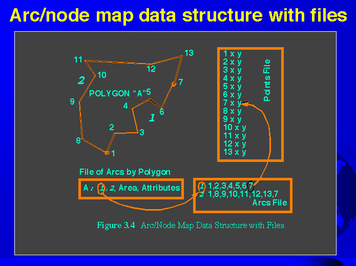
Arc/node map data structure with file - GRAPHIC
Topology, GIS, and You
Topological data structures dominate GIS software
Nodes that are close together are snapped - GRAPHIC
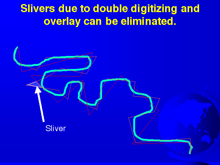
Slivers due to double digitizing and overlay can be eliminated - GRAPHIC
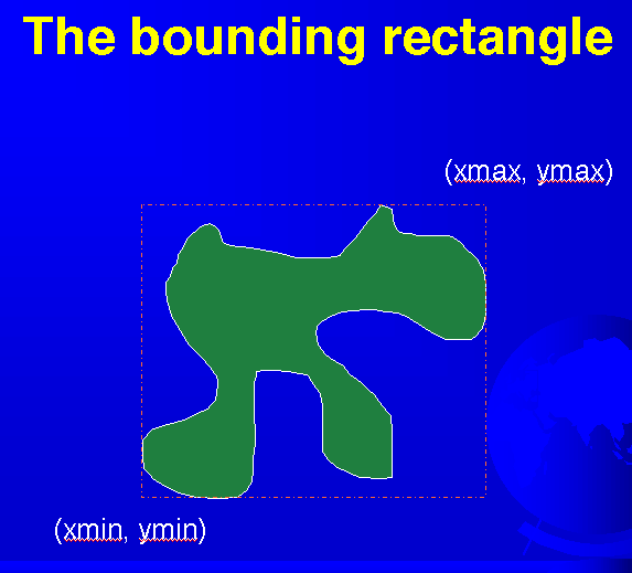
The bounding rectangle - GRAPHIC
Why Topology Matters
Topology allows automated error detection and elimination
"Rasters are faster, but vectors are correcter"
Vector can represent point, line, and area features very accurately