Maps as Numbers - Part 2
NSDI Notes
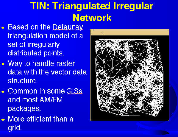
TIN: Triangulated Irregular Network - GRAPHIC

A TIN can be used to represent surfaces
Based on the Delaunay triangulation model of a set of irregularly distributed points. Way to handle raster data with the vector
data
structure.
Common in some GISs and most AM/FM packages
More efficient than a grid
Data formats can be industry standard, commonly accepted or standard
Page languages are HPGL, PostScript, and Autocad DXF
True vector GIS data formats are DLG and TIGER, which have topology
Most GISs accept TIF, GIF, JPEG or encapsulated PostScript, which are not georeferenced
DEMs are true raster data formats
If a GIS supports many data structures, changing structures becomes the users responsibility
Changing vector to raster is easy; raster to vector is hard.
Data also are often exchanged or transferred between different GIS packages and computer systems
The history of GIS data exchange is chaotic and has been wasteful
In the United States, the SDTS was evolved to facilitate data transfer
SDTS became a federal standard (FIPS 173) in 1992
SDTS contains a terminology, a set of references, a list of features, a transfer mechanism, and an accuracy standard
Both DLG and TIGER data are available in SDTS format
Other standards efforts are DIGEST, DX-90, the Tri-Service Spatial Data Standards, and many other international standards
Efficient data exchange is important for the future of GIS
Web site of the week... http://buccaneer.geo.orst.edu
Formats
Most GIS packages can import different data formats, or use utility programs to convert them
Vector Data Formats
Vector formats are either page definition languages or preserve ground coordinates
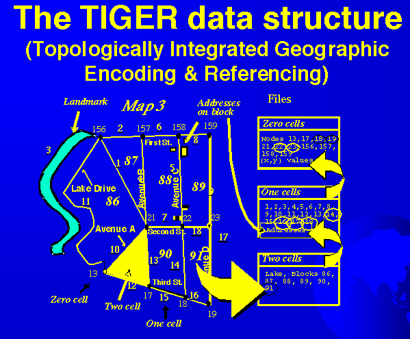
The TIGER data structure - GRAPHIC

Raster Data Formats
Most raster formats are digital image formats
Data Exchange
Most GISs use many formats resulting from one data structure
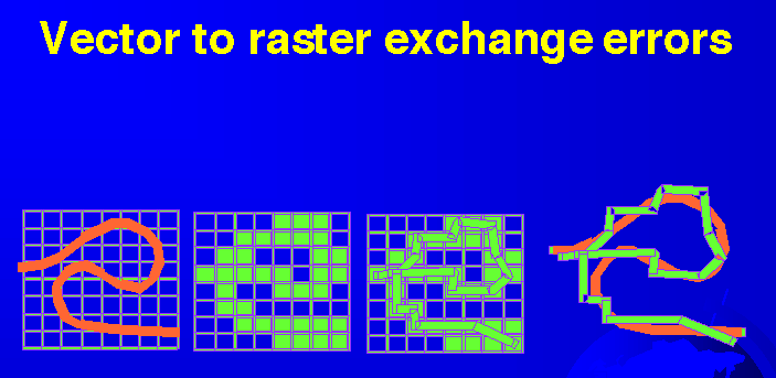
Vector to raster exchange errors - GRAPHIC

Transfer Standards
GIS Data Exchange
Data exchange by translation (export and import) can lead to significant errors in attributes and in geometry
Overview of the National Spatial Data Infrastructure (NSDI)
Oregon and...
of participants
http://dusk.geo.orst.edu/gis/lec06.html