GEO 465/565 - Supplement to Lecture 9
Getting the Map Into the Computer - Part 2
Geocoding is the conversion of spatial information into digital form.
Geocoding involves capturing the map, and sometimes also capturing the attributes.
The method of geocoding can influence the structure and error associated with the spatial information which results.
Example: scanning (raster), digitizing (vector).
Digitizing
Scanning
Field Data Collection
Captures map data by tracing lines from a map by hand
Uses a cursor and an electronically-sensitive tablet
Result is a string of points with (x, y) values
Stable base map
Fix to tablet
Digitize control
Determine coordinate transformation
Trace features
Proof plot
Edit
Clean and build
Cursor data entry
Secondary tablet (menu/template)
Voice command entry
Point mode
Stream mode
Point select mode
Slivers
Duplicate lines
Duplicate nodes
Unended lines
Gaps
Zingers
Places a map on a glass plate, and passes a light beam over it
Measures the reflected light intensity
Result is a grid of pixels
Image size and resolution are important
Features can drop out
Logically can be thought of as a simple file
Table with rows and columns
Attributes by records
Entries called values.
Data definition module sets constraints on the attribute values
Data entry module to enter and correct values
Data management system for storage and retrieval
Legal data definitions can be listed as a data dictionary
Database manager checks values with this dictionary, enforcing data validation.
Type of value
Range
Missing data
Duplicate data
Key
Enforcement for map data is usually by using topology.
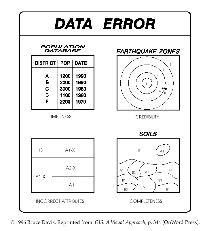
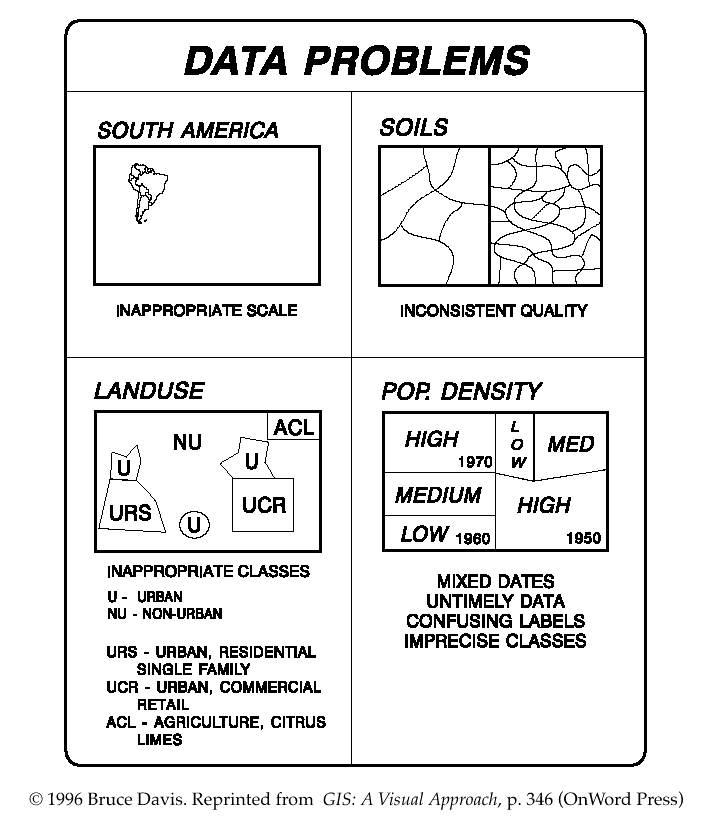
Map and attribute data errors are the data producer's responsibility, but the GIS user MUST understand error.
psychomotor- digitizing operator can't see the line or can't properly move
the cross-hairs along the line
* may also involve misinterpretation or too much generalization
* not easy to remove these automatically
* in spite of physiological and psychomotor errors, digitizing itself is not a
major source of positional error
* also errors in registration & control points, as well as shrinkage or
shredding of paper
* attributes usually obtained through a combination of field collection and
interpretation
* categories may be subjective (e.g., "diversity," or "old growth" used inforest mgmt.)
* attributes such as these may not be easy to check in the field
* for social data, a major source of inaccuracy is undercounting, e.g., missing
certain social groups in a Census
Accuracy and precision of map and attribute data in a GIS affect all other operations, especially when maps are compared across scales.
http://dusk.geo.orst.edu/gis/lec09.html
Return to GEO 465/565 Syllabus