
[ home port | lectures | labs | surf | email prof. ]
--ocean floor not flat - significant topographic relief
German ship Meteor (1920s) - 1st echosounding survey
--light does not travel very far in water
--sounds travels through water much better
<--------------------X-------------------->

Image courtesy of D. Reed, San Jose State Geology
--SONAR (Sound Navigation and Ranging)
WWII - U.S. Navy further developed SONAR technology
1950s - 1960s - single, focused high-frequency, short wavelength sound beam
--sound beam spreads out as it reaches bottom
--range of depths - fuzzy estimate
1970s - revolution in bathymetric mapping with Sea Beam
multiple, focused, high-frequency, short wavelength sound beams
--narrow-beam or multibeam bathymetry
--sound beam stays narrow and focused all the way to the bottom
--Sea Beam has 16 beams, Sea Beam 2000 has 121
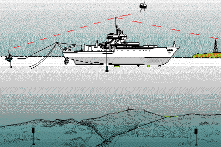
Image courtesy of D. Reed, San Jose State Geology
with Sea Beam can see things on seafloor the size of this room
--swath width of 6 km or 3.7 miles
good, high-resolution maps possible only since 1980s
other instruments needed to see things smaller than size of room
--remotely-operated vehicles (ROVs)
an x-ray of seafloor to see structure BENEATH seafloor
--seismic reflection & seismic refraction
--low frequency, long-wavelength sound
sidescan sonar to get pictures of seafloor in addition to depth
--backscatter strength as opposed to traveltime
continental slope - steep slope beyond the continental shelf break
slopes often cut by submarine canyons
--turbidity currents - dense flows of sediment-laden water
abyssal plain - extensive, flat
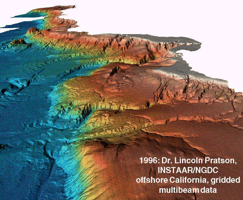
Image courtesy of L. Pratson and B. Haxby, Lamont-Doherty Earth Observatory
--flat-topped ones are called guyots
--volcanic features (buoyed up by hot rock, lava)
abyssal hills - features around 200 m high
--volcanic AND tectonic in origin - still debated
Plate Boundaries - Ridges (Rises), Trenches, Transform Faults, Fracture Zones
Last update: March 31, 2000
http://dusk.geo.orst.edu/oceans/lec03.html