[ Policy | Contacting UCGIS | UCGIS Newsletter | Downloads | Links ]

UCGIS POSTER
UCGIS POSTER
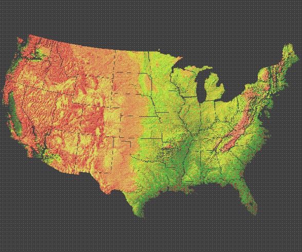
The colors representing shaded relief in the poster define fifteen gradations where the hue of the image is adjusted to enhance the elevation change. The highest elevations are saturated as red, transitioning through orange to green, and finally to the lowest elevations depicted by dark green. An iterative process adjusted both image brightness and contrast to construct the final 24 bit product. The final 325MB digital file was transferred directly to the printer where negatives and plates were produced. Subtle color adjustments in the ink proportions in different regions of the print were made while the press was running.
Three entities collaborated on this project: the Cartography Laboratory at the University of Colorado (Boulder), Computer Terrain Mapping, Inc. (Boulder), and the AEGIS Laboratory at the University of California (Berkeley).
UCGIS POSTER
c/o Susan McDonald Jampoler
Executive Director UCGIS
43351 Spinks Ferry Rd.
Leesburg, VA 20176-5631
This amount includes the $10 cost of the poster, a shipping tube and
regular Parcel Post. Add $2 for Priority mail or $11 for overnight
shipping.