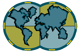
The Global Grid Project - This research, sponsored by the U.S. EPA,
addresses improved cartographic methods for sampling and analyzing environmental phenomena across the
globe. The focus is on alternative ways of partitioning the globe into sampling units. Using a
rigorous statistical approach, these alternatives make possible accurate counting and statistical analyses
of trees, owls, whales, or any other populations. Sampling systems have been optimized for the
State of Oregon, the
rest of the U.S., and now our scientists are now receiving requests from
international agencies.
Principal contact: Dr. Jon Kimerling, OSU Geosciences,
bufo.geo.orst.edu/tc/firma
Key words: Global mapping and sampling, natural resources
management, information management
Coastal Landscape Analysis and Modeling Study (CLAMS) -
OSU and the U.S. Forest Service
have funded this large interdisciplinary study in order to predict vegetation
patterns in 5-year increments. Using Landsat satellite imagery, land
ownership data, advanced geographic information system (GIS) techniques,
and knowledge of how land owners currently manage their lands, the
project is developing forest stand simulation models for deriving future
vegetation conditions, which can then be incorporated into resource
management policies to increase their effectiveness. CLAMS will be
critical to the effective implementation of the Northwest Forest Plan
and the Governor's Salmon Initiative.
Principal contacts: Ms. Sharon Clarke & Dr. Gordon Grant, OSU Forest Science,
www.fsl.orst.edu/clams
Key words: Satellite mapping, GIS, stream ecology, forest policy,
biodiversity
Future Scenarios for Muddy Creek Watershed, Benton
County, Oregon - This EPA-funded project,
a collaboration between OSU Geosciences, and the University of Oregon
Institute for a Sustainable
Environment, illustrates a unique framework and methodology for
helping local communities to create
alternative scenarios for land conservation and development. Using a
representative region within the
Willamette Valley and working with the people who actually reside and
make their living in the area,
the project creates a spectrum of futures depicting conservation and
development scenarios in varying
intensities, locations, and with resulting effects on biodiversity and water
quality. A myriad of data from
satellites, demographic surveys, land surveys, hydrological and
ecological studies, etc. was integrated,
run through statistical models and mapped with a GIS.
Principal contact: Mr. Denis White, EPA,
ise.uoregon.edu/Muddy/Muddy_abstract.html
Key words: Land use planning, water quality, biodiversity, satellite
mapping, GIS
Oregon Biodiversity Analysis Project - This project is necessary
for the survival of endangered
species within the state of Oregon. It examines species diversity for the
State using a hexagonal
grid system (as opposed to the conventional square grid). The
programming algorithms of the
project produce maps showing the best locations for maximizing the
abundance of species native
to a region. Species richness maps may be created for terrestrial vertebrate
diversity; rare, threatened,
and endangered species diversity; and vegetation cover diversity.
Principal contact: Dr. Ross Kiester, OSU Geosciences & Forest Science,
bufo.geo.orst.edu/brc
Key words: Endangered species mapping, biodiversity, habitat
protection
El Nino Hazard Mapping - Various researchers at OSU are
monitoring Oregon coast shoreline
changes due to the 1997-'98 El Nino event, as well as mapping and
modeling storm-induced
landslide events directly on the coast and in the Coast Range.
Principal contact: Dr. Chuck Rosenfeld, OSU Geosciences; Dr. George
Taylor, OSU Atmospheric
Sciences and Oregon Climate Service,
www.ocs.orst.edu/reports/enso_pnw.html
Key words: El Nino, hazard mapping, coastal management, disaster
response
Confederated Indian Tribes - OSU researchers are working with the
Confederated Tribe of the
Siletz Indians to develop land and water GIS databases for the Siletz
River Basin. These databases
will assist the tribe in reviewing their water and land resource options
through changing conditions,
and in devising more effective strategies for managing these resources.
Principal contact: Dr. Philip Jackson, OSU Geosciences,
jacksonp@geo.orst.edu
Key words: Native American advocacy, natural resources management,
GIS, environmental justice
Don't Forget the Ocean! Various researchers at OSU are mapping
earthquake activity off the Oregon
coast, characterizing the shoreline and the seafloor with maps of
unprecedented detail, and monitoring
the free-ranging populations of humpback, gray, minke, fin, and blue
whales. With 1998 being a
strong El Ni–o year, as well as the United Nations International Year of
the Ocean, these research
projects are garnering quite a bit of interest from the general public.
Principal contact: Dr. Chris Fox, NOAA & OSU Oceanography,
www.pmel.noaa.gov/vents
Key words: ocean mapping/management/protection, earthquakes,
whales, tsunami hazard mitigation
![]()
![]()
![]()