
Page 31 - GIS for Science: Technology Showcase
P. 31
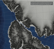
The northern coast of Greenland is revealed by the Arctic DEM Explorer, a web app that enables the exploration of Arctic elevation based on the 2 m resolution Arctic DEMs created by the Polar Geospatial Center. The app displays multiple renderings as well as profiles of the data. See the link at GISforScience.com.
