
Page 33 - GIS for Science: Technology Showcase
P. 33
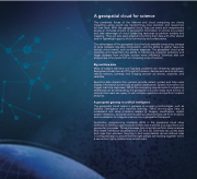
 A geospatial cloud for science
The combined forces of the internet and cloud computing are clearly impacting—some would say transforming—how scientists and researchers do their work. With the geospatial cloud, they can easily and inexpensively access an immense amount of geographic information on almost any subject and take advantage of cloud computing resources to perform analysis and mapping. They can also easily share and combine their data with other shared data in lightweight apps to build community and collaboration.
The advantages of the geospatial cloud include scalable computing, storage of large datasets, big-data computation, and the ability to gather resources during critical events, such as disaster response. The geospatial cloud gives scientists and researchers the ability to handle big analytical problems and larger datasets from multiple sources more efficiently. Scientists also can analyze real-time inputs from an increasing array of sensors.
Big real-time data
Most of today’s real-time and big-data problems are inherently geospatial. Examples include Internet of Things (IoT) sensors; devices such as smartphones; vehicle sensors; cameras; and imaging sensors on drones, airplanes, and satellites.
Real-time data streams from sensors provide instant context and help users display information dynamically as spatial dashboards. Spatial information can trigger real-time responses. While the computing requirements for situational awareness can be demanding, the geospatial cloud can easily store billions of records that users can query to ask complex questions and perform location analytics.
A geospatial gateway to artificial intelligence
The geospatial cloud opens a gateway to emerging technologies, such as artificial intelligence and machine learning. These technologies help us understand and solve problems related to imagery classification, spatial pattern detection, and predictive modeling. Data scientists use AI for analytics and visualization to integrate science into a geospatial framework.
Application programming interfaces (APIs) in the geospatial cloud allow scientists to develop apps that blend their own methods and algorithms with geospatial processes. These processes help scientists perform deep analyses and create interactive visualizations in 2D and 3D. Scientists can access apps and maps from wherever they log in. And organizations can set defined roles in configured apps to ensure that the right people are working together within a secure but highly collaborative environment.
                                          A Glacier in Retreat 217
