
Page 22 - GIS for Science: Technology Showcase
P. 22
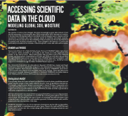
  ACCESSING SCIENTIFIC
DATA IN THE CLOUD MODELING GLOBAL SOIL MOISTURE
Kevin Butler, Esri
The practice of science has changed. Scientists increasingly acquire data instead of just directly measuring or observing the data. While independent field observations continue to be important, the familiar leather-bound field notebook has given way to massive central repositories of scientific data often remotely sensed by satellites, automated cameras, autonomous buoys, and drones. The availability of these massive repositories has impacted the spatial scale at which scientists work. These changes in the practice of science are particularly noticeable in the domains of the atmospheric, ocean, and solid earth sciences.
OPeNDAP and THREDDS
Open-source Project for a Network Data Access Protocol (OPeNDAP) makes data stored on a remote server accessible to you locally, in the format you need, regardless of its format on the remote server. Many authoritative data providers, such as The National Oceanic and Atmospheric Administration (NOAA) and NASA, provide their data product through OPeNDAP data servers. A key value of the OPeNDAP approach is its ability to pull data subsets from the server to get only the data that is relevant to you. ArcGIS® provides support for OPeNDAP through the Make OPeNDAP Raster Layer tool.
The University Corporation for Atmospheric Research (UCAR) has created and freely distributes a web server specifically designed for the dissemination of scientific data. The Thematic Realtime Environmental Distributed Data Services (THREDDS) Data Server (TDS) is a web server that provides metadata, web-based catalogs of data and data access protocols for scientific datasets. In addition to OPeNDAP, THREDDS can deliver data as OGC WMS and WCS services, HTTP, and other remote data access protocols.
Storing data in NetCDF
Conceptually, Network Common Data Form (NetCDF) stores the data as multidimensional arrays. Intuitive arrays of data enable efficient access to data along different dimensions. For example, using the same dataset, you may want to draw a 2D map of temperature at a particular altitude and time or create a line graph of temperature values through time at a single location for a specific altitude. In the netCDF file, the data would be represented as a 4D array: temperature (x, y, altitude, time).
The Open Geospatial Consortium (OGC) has adopted NetCDF as a core encoding standard. You can store any type of spatial data in a netCDF file, including atmospheric and oceanic sciences data. The netCDF has the major benefit of containing metadata information and a standard way to describe what each variable represents, its measurement units, and the spatial and temporal properties of the data.
ArcGIS Pro provides a set of tools to represent observations and models as data tables, points, raster fields, or multidimensional raster layers. These tools read netCDF files and format their contents into the corresponding GIS structures, including animations and time-series analysis.
200 GIS for Science
.
