
Page 53 - GIS for Science: Technology Showcase
P. 53
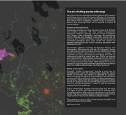
  The art of telling stories with maps
Many of the sciences, especially those that deal with Earth systems and biology, have to do with location. Whether it’s the stately grinding of tectonic plates or the interdependencies of plants and animals within ecosystems, location is key to discerning patterns and detecting trends. Just as essential to science is communication.
Beautiful multimedia stories
Increasingly, scientists are using the web to share their findings with broader audiences. The web enables instantaneous publication, frequent updating, and use of rich multimedia: text, images, video, infographics, and maps. But maintaining custom websites and managing multimedia content can be daunting. Enter ArcGIS® StoryMaps, a web app that demystifies multimedia publishing. Story maps enable the creation of beautiful multimedia stories without requiring specialized web development skills.
Government agencies, including the National Oceanic and Atmospheric Administration and the US Geological Survey, are making story maps to interpret scientific research for broad audiences. Academic departments in scores of colleges and universities are using story maps as instructional tools and are challenging students to create their own. NGOs are creating story maps as well: GRID-Arendal produced the story map on eutrophication in the Baltic Sea shown on these pages; it’s one of a series of stories that enables GRID-Arendal to pursue its mission of “organizing and transforming available environmental data into credible, science-based information products.”
Modes of persuasion
Aristotle’s “modes of persuasion” provide a road map for storytelling that is useful for scientists today. Logos, the natural habitat of scientists, uses reason to persuade an audience. Ethos, conveying the authority and credibility of the persuader, requires scientists to defy their habits and place themselves in the narrative. Pathos might be the biggest stretch for scientists trained on objectivity. But all scientists have a passion for their work and can tap that passion in order to elicit an emotional response from their audiences.
Finally comes Kairos, bringing time and place into the story. It is place, of course, that makes story maps a uniquely useful storytelling platform. Maps add extra dimensions to multimedia stories. They pin a narrative to place. They place a story within a larger context. They provide additional, deeper insights.
Story maps are a way to help science become accessible and scientists to become storytellers.
Allen Carroll, Esri.
A Glacier in Retreat 237
