
[ home port | rogues | newbies | booty | voyages | viz | papers | links | email the captain ]

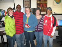 2011 rogues (minus Dylan away on travel) |
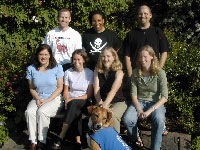 The first large crew of rogues, 2003 |
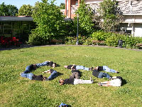 Can you spell G-I-S?? |
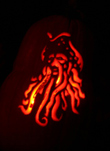 Departmental Pumpkin-Carving Contest Winner |
 Another Pumpkin-Carving Contest Winner |
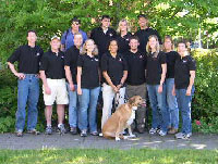 Wearing official lab shirts... |
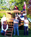 Pirates of the Willamette Valley... |
 Dori Dick |
Dori Dick entered our Geography doctoral program in the Fall of 2010. As a Master student at San Francisco State she served as the assistant chair of the scientific program for the 1st International Marine Conservation Congress (IMCC), sponsored by the Marine Section of the Society for Conservation Biology, and continues to serve as Education and Outreach Chair for the 2011 IMCC. After earning her M.S. in geography there, she worked as a GIS Analyst for the North Atlantic Right Whale Program with the Florida Fish and Wildlife Institute (FWRI), where she integrated GIS methods and spatial statistical techniques to provide information to natural resource managers. Dori played a very large role in our Office of Naval Research grant, geneGIS: Computational Tools for Spatial Exploration of Individual-based Genotyping and Photo-identification Records of Marine Megafauna in close collaboration with the Scott Baker lab group. Dori's dissertation topic (successfully defended on October 19, 2012) is Spatio-Temporal Analysis and Modeling in the Marine Environment: Humpback Whale Genetic Variability and Seabird Distributions in the Northeastern Pacific Ocean. Dori successfully advanced to doctoral candidacy on March 1, 2013. She was then selected for the 2016 Class of Knauss Marine Policy Fellows, to serve as a Protected Species Program Specialist on Climate Change in the NOAA Fisheries Office of Protected Resources. This work has her based at NOAA headquarters in Silver Spring, MD. But Dori successfully defended her dissertation and enjoyed a great Commencement in June 2016. |
|
Dylan Keon, Ph.D., 2012
Dissertation Title: Automated Web-based Analysis and Visualization of Spatiotemporal Data Dylan continues to be a full-time GIS Coordinator, Database Administrator, and Project Manager with the Northwest Alliance for Computational Science and Engineering (NACSE) at OSU. He pursued his Ph.D. part-time while working full-time for NACSE. |
|
Colleen Sullivan, M.S. 2012
Thesis Title: Assessment of the Potential for Conflict between Existing Ocean Space Use and Renewable Energy Development off the Coast of Oregon Colleen now works in Oakland, CA office of Ecology & Environment as a contractor for the EPA's START (Superfund Technical Assessment and Response) team. She performs general data management and GIS project work, as well as field work for Hazardous Waste Operations and Emergency Response. |
|
Jen Bauer, M.S. 2012
Research Paper Title: Assessing the Robustness of Web Feature Services Necessary to Satisfy the Requirements of Coastal Management Applications Jen is now a geospatial data specialist for a geological and environmental science research team of the National Energy Technology Laboratory in Albany, OR, and worked for a time in collaboration with the Spatial Environmental Energy Research (SEER) research group at OSU. |
|
Kelvin Raiford, M.S. 2011
Data Compilation Report Title: The Use of Geospatial Data to Support Vulnerability Mapping of the Oregon Coast Kelvin continues his interests in coastal issues and has returned home to North Carolina to seek employment. |
|
Debbie Reusser, Ph.D., 2010
Dissertation Title: Biogeography of Nonindigenous Species: From Description to Prediction Debbie continues to be a full-time research geographer with the USGS-Western Fisheries Science Center, based at the Hatfield Marine Science Center in Newport, OR. She pursued her Ph.D. part-time while working full-time for the USGS. |
|
Michelle Kinzel, M.S., 2009
Research Paper Title: Using Educational Tools and Integrative Experiences via Geovisualizations that Incorporate Spatial Thinking, Real World Science and Ocean Literacy Standards in the Classroom: A Case Study Examined Michelle moved back to her "hometown" of San Diego and was recently hired by the Cal-State San Marcos Instructional Technology and Development team to support the use of GIS for courses, faculty and students across that entire campus. She was also an instructor for two of our E-Campus GIS distance ed. courses here at OSU. |
|
Kyle Hogrefe, M.S., 2008
Thesis Title: Derivation of Near-shore Bathymetry from Multispectral Satellite Imagery Used in a Coastal Terrain Model for the Topographic Analysis of Human Influence on Coral Reefs After graduation Kyle continued in the lab as a post-graduate researcher, doing contract work for the NOAA Coral Reef Ecosystem Division within their Pacific Islands Fisheries Science Center. For many years he served as a geographer with the USGS Alaska Science Center in Anchorage, where he mapped sea grasses in western AK using Landsat and Ikonos, and made seasonal statewide assessments of the photosynthetic activity of tundra using MODIS NDVI (comparing it also to bird species distribution). He also got into the field quite a bit to do groundtruthing! Kyle plans to return to OSU to work on a doctorate in Geography with Prof. Hannah Gosnell. |
|
Tiffany Vance, Ph.D., 2007
Dissertation Title: If You Build It, Will They Come? Evolution Towards the Application of Multi-Dimensional GIS to Fisheries Oceanography Tiffany continues to be a full-time database programmer and research scientist at the NOAA Alaska Fisheries Science Center (AFSC) in Seattle, with continued interests in marine GIS, web mapping, 3-D visualization, and history of science. She also holds an adjunct faculty appointment in the Department of Geography at San Francisco State University. Tiffany pursued her Ph.D. part-time while working full-time at the AFSC. |
|
Deidre Sullivan, M.S., 2007
Research Paper Title: Developing a Plan for the National Coordination of Geospatial Technology Education: A Community College Perspective Deidre continues to be the Director of the Marine Advanced Technology Education (MATE) Center in Monterey, CA, as well as an instructor at Monterey Peninsula College (MPC). She pursued her degree part-time will working full-time at MATE/MPC. |
|
David Bradford, M.S., 2007
Research Paper Title: A Geospatial Data Catalog and Metadata Management Tools for the U.S. Environmental Protection Agency's Western Ecology Division Upon graduation David continued his interests in geographic information science and agent-based modelling, and secured a position with the Oregon Dept. of Fish & Wildlife. Sadly, David passed away on February 13, 2009. |
|
Jed Roberts, M.S., 2007
Thesis Title: The Marine Geomorphology of American Samoa: Shapes and Distributions of Deep Sea Volcanics Jed is now a Geospatial Data Coordinator for the Oregon Dept. of Geology and Mineral Industries (DOGAMI) in Portland. He is responsible for managing their digital map and information libraries, providing web tools for presentation to the public, and working with geologic models for landslide susceptibility, watershed hydrologies, tsunami inundation, and eventually, seamless terrain models that will include near-shore multibeam bathymetry. |
|
Brett Lord-Castillo, M.S., 2007
Thesis Title: Arc Marine as a Spatial Data Infrastructure: A Marine Data Model Case Study in Whale Tracking by Satellite Telemetry Brett was hired in the summer of 2007 by the St. Louis County (Missouri) Police Department, Office of Emergency Management, as an Information Systems Designer and GIS Programmer. In the spring of 2008, Brett played a crucial role in flood relief efforts, during that disaster that hit Missouri. |
|
Steve McClung, M.S., 2005
Thesis Title: Lahar Hazard Mapping of Mount Shasta, California: A GIS-based Delineation of Potential Inundation Zones in Mud and Whitney Creek Basins Upon graduating from OSU, Steve worked as an intern with the Alaska Satellite Facility, housed at the Geophysical Institute of the University of Alaska-Fairbanks. He then went on to an environmental internet consulting/development company called EEI (Engineering and Environmental Internet Solutions, LLC) in Fairbanks, AK. In May of 2012 he took a position with LinkedIn as a UI Software Engineer and currently focuses on User Interface and Visualization for Data Products supporting the LinkedIn Economic Graph. |
|
Peter Bower, M.S., 2005
Research Paper Title: Using an Internet Map Server and Coastal Remote Sensing for Education Pete was a student assistant at the 2005 ESRI User Conference (pictured to far right of Jack Dangermond). After finishing at OSU he moved to Portland and to work as a GIS and LIDAR analyst for Watershed Sciences, Inc.. He now works as a mapping specialist for EnXco, a wind power generation company in Portland, OR. |
|
Colin Cooper, M.S., 2005
Research Paper Title: Building and Sharing Spatial Metaphors for the Catalogue of Oregon Marine and Coastal Information (COMCI) Colin has risen the ranks to project manager with Watershed Sciences, Inc. in Corvallis. |
|
Keldah Hedstrom, M.S., 2005
Thesis Title: Introducing Geographic Information Systems to Grass Seed Growers in the Willamette Valley of Oregon After graduation Keldah secured a position as a GIS analyst with Ranch Resources, LLC in Sheridan, MT. She then returned "home" to Oregon and was a resource conservationist doing planning and GIS with the Marion County Soil & Water Conservation District. She has also started her own company, Agricultural Technology Services, while working also for Alsea Geospatial! |
|
Chad Keith, M.S., 2004
Thesis Title: GIS Modeling of Potential Marine Protected Areas in the Northwest Atlantic via Biological and Socioeconomic Parameters Chad has returned to his full-time position as a research assistant at the NOAA NMFS Northeast Fisheries Science Center headquarters in Woods Hole, MA. |
|
Chris Zanger, M.S., 2004
Thesis Title: "Modeling the Environmental Protection Agency's Level IV Ecoregions within the Klamath Mountains of Southern Oregon and Northern California: A Geographic Information System Approach" Chris was a summer 2004 intern at ESRI headquarters in Redlands, CA. After graduating he was hired as a GIS analyst with the Bureau of Land Management (BLM), Prineville District Office, central Oregon, and then became a research assistant and instructor at Southern Oregon University. He worked as a GIS Specialist with the National Park Service's Inventory and Monitoring Program with a focus on the "Klamath Network," as well as a GIS instructor at Southern Oregon University. Chris is now a Fire Research Analyst with The Nature Conservancy in Bend, Oregon. |
|
Emily Larkin, M.S., 2004 (email)
Thesis Title: "Geographic Information Systems for Coral Reef Conservation, Capacity Building, and Public Education in American Samoa" From OSU Emily went on to a stint as a Knauss Marine Policy Fellow with the NOAA National Ocean Service in Silver Spring, MD, and is continued on with NOAA full-time. She is currently working for NOAA's R&D High Performance Computing program. |
|
Peter Martin, M.S., 2004
Thesis Title: "Spatial Interpolation in Other Dimensions" After graduating Pete continued working as a sea-going science support privateer (electronics technician, among other talents), contracting with MicroSeismic, Inc., Raytheon Polar Services Company, Antarctic Support Associates, and the Woods Hole Oceanographic Institution. He is now pursuing a Ph.D. at the Spatial Information Research Centre of the University of Otago in New Zealand, on a New Zealand International Doctoral Research (NZIDR) scholarship. |
|
Alyssa Aaby, M.S., 2004
Thesis Title: "Testing the ArcGIS Marine Data Model: Using Spatial Information to Examine Habitat Utilization Patterns of Reef Fish along the West Coast of Hawaii" Alli is a seafloor mapping and GIS specialist with the Department of Geology & Geophysics. She was also a presenter and a Student Assistant at the 2004 ESRI User Conference. |
|
Emily Lundblad Hirsch, M.S., 2004
Thesis Title: "The Development and Application of Benthic Classifications for Coral Reef Ecosystems Below 30 m Depth using Multibeam Bathymetry: Tutuila, American Samoa" Upon graduation Emily took a post as GIS specialist with the Benthic Habitat Mapping Group of the Coral Reef Ecosystem Division, NOAA NMFS Pacific Islands Fisheries Science Center in Honolulu. She is now a senior analyst with Geospatial Consulting Group International. |
|
Curt Whitmire, M.S., 2003
Thesis Title: "Integration of High-Resolution Multibeam Sonar Imagery with Observational Data from Submersibles to Classify and Map Benthic Habitats at Heceta Bank, Oregon" co-advised and funded by Bob Embley, NOAA PMEL Vents Group Curt is as an information technology specialist in the Fishery Resource Analysis and Monitoring Division of the NOAA Northwest Fisheries Science Center in Seattle. He is involved in designing trawl surveys, analyzing spatial data for enhancement of the essential fish habitat database, and analyzing a variety of data for the assessment of groundfish resources off the West Coast. |
|
Kuuipo Walsh, M.S., 2002
Research Paper Title: "Developing 'Humane' Interfaces to Data Clearinghouses for Improving the Delivery of Spatial Information to Marine Resource Managers" Kuuipo is a GIS analyst with the Institute for Natural Resources on the OSU campus. |
|
Liz O'Dea (now Liz Springborn),
M.S., 2002
Thesis Title: "Integrating GIS and Community Mapping into Secondary Science Education: A Web GIS Approach" Liz has recently returned to the U.S. after several years in IRELAND as a GIS specialist with the Coastal & Marine Resources Centre (CMRC) in Cork, where she led the development of the Marine Irish Digital Atlas. CMRC and MIDA remain close collaborators with DJL. She is now a GIS analyst/programmer with state of Washington Department of Ecology GIS Technical Services Unit. Part of her duties involve further development of the Washington Coastal Atlas. |
|
Gillien Duvall, M.S., 2000
Research Paper Title: "Metadata for the Oregon Coast Geospatial Clearinghouse: Concept, Implementation, and Maintenance" Formerly on staff with Oregon Geospatial Enterprise Office, Gillien is now a GIS specialist with the Enhanced 911 Program within Oregon Emergency Management. |
|
Michelle Wargo Rub, M.S., 2000
Research Paper Title: "A Novel Landscape Ecology Approach for Determining Microhabitat Correlations and Faunal Patchiness in Extreme Environments: Pilot Study for the Southern East Pacific Rise at 17-18° S" Now working as a data analyst in the Conservation Biology division of the NOAA Northwest Fisheries Science Center in Seattle. |
|
David Revell, M.S., 2000
Thesis Title: "Using Geographic Information Systems and Remote Sensing to Support Community-Based Coastal Hazards Planning in the Netarts Littoral Cell, Oregon" co-advised and funded by Jim Good, OSU Marine Resource Mgmt. Program
Now a senior associate in coastal management with Environmental Science Associates in San Francisco. |
|
Kelly Chapin Palacios, M.S., 2000
Thesis Title: "The Potential of Dynamic Segmentation for Aquatic Ecosystem Management: Pacific Lamprey Decline in the Native Lands of the Confederated Tribes of Siletz Indians" Formerly a researcher for the Conservation Biology Institute in Corvallis, and now the Spatial Projects Coordinator for the National Marine Protected Areas Center Sciences Institute in Monterey, California. |
|
Nicole Nasby Lucas, M.S., 2000
Thesis Title: "Integration of Submersible Transect Data and High-Resolution Sonar Imagery for a Habitat-Based Groundfish Assessment of Heceta Bank, Oregon" Nicole is a research biologist for the Pfleger Institute of Environmental Research near San Diego. |
|
Brian Ward, M.S., 2000
Research Paper Title: "The Implementation of Two Distributed Databases of Water-Related Information" Brian is a GIS Developer/Analyst with Critigen (formerly CH2M-Hill) in Colorado. |
|
Jennifer Engels, Honors B.A. in International Studies in Geology Honors B.S. in Geology, 1999 Thesis Title: "The Challenges of Relocation: The Effects of Internal and External Migration on Vietnamese Families" Jennifer went on to obtain her doctorate in Marine Geology and Geophysics with Dr. Margo Edwards of the Hawai'i Mapping Research Group, University of Hawai'i School of Earth Ocean Science & Technology (SOEST). She continues there as a Research Associate. |
|
Hamilton Smillie, M.S., 1998, (email)
Thesis Title: "The Role of GIS in Bringing Science to Coastal Management and Better Data Management to Science" Hamilton is an Operations Manager in Geospatial Servies at the NOAA Coastal Services Center. |
|
Chuck Schonder, M.S., 1998
Thesis Title: "Geographic Information System Implementation for Coastal Management on Small Islands, With a Case Study on Saipan, Commonwealth of the Northern Mariana Islands" Hired October '98 by the State of Delaware Dept. of Natural Resources as an environmental scientist within their Coastal Management Program (Division of Soil & Water Conservation). He is now working in Santa Barbara as an environmental educator, private consultant, and outdoor guide. |
|
Brendan Sylvander, M.S., 1998 Thesis Title: "The Southeast Indian Ridge: H20 Contents of MORB Glasses and Chemical Effects of Propagating Rifts" This marine geologist-extraordinaire tried his hand at GIS projects for the OSU Research Forest and as a GIS analyst and webmaster for Alsea Geospatial. He then worked as a GIS specialist for the Wisconsin State Department of Commerce. Brendan now works for the NOAA National Marine Fisheries Service in the Seattle area. |
|
Larissa Lubomudrov, M.S., 1997 Thesis Title: "Application of Scientific Information in Marine Resource Management: Three Case Studies" Entered the doctoral program of the School of Natural Resources & Environment, University of Michigan, fall 1998, went on to work for Michigan Sea Grant, and may now be with the NOAA Great Lakes Environmental Research Laboratory in Ann Arbor, MI. |
 [ home port |
rogues |
newbies |
booty |
voyages |
viz |
papers |
links |
email the captain ]