[ Home |
About UCGIS |
Membership |
Research |
Education |
Opportunities |
UCGIS Events ]
[ Policy |
Contacting UCGIS |
UCGIS Newsletter |
Downloads | Links ]

About UCGIS: [ Introduction |
Purpose |
Multidisciplinary |
UCGIS Articles |
UCGIS Bylaws |
History ]
[ MINUTES of Meetings |
Current Officers and Board Members |
Committees |
Brochure]


The Initial Idea for UCGIS
 In 1988, the U.S. National Science Foundation established the National Center for Geographic Information and Analysis (NCGIA), a consortium of three institutions: the University of California at Santa Barbara, the State University of New York at Buffalo, and the University of Maine. The primary mission of the NCGIA was to conduct basic research, but the organization was also asked, from time to time, to provide services or coordination for members of the broader Geographic Information Science community. In 1990, the NCGIA board of directors recommended that a more broadly-based organization be established to promote and support the field, especially the needs of researchers. After continued discussions in 1991, the NCGIA responded by establishing an ad hoc steering committee consisting of 16 individuals from as many institutions, representing about seven different academic disciplines. After a series of meetings at professional conferences, sufficient momentum was gathered to establish a national conference on the issue in Boulder, Colorado.
The Boulder Meeting
 On December 4, 1994, forty-two individuals representing thirty-three universities, research institutions, and the Association of American Geographers (AAG), met in Boulder, Colorado to establish the University Consortium for Geographic Information Science (UCGIS).
 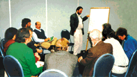 Representatives were invited by the presidents and chancellors of seven U.S. research universities with prominent programs in Geographic Information Systems.
Out of this Boulder meeting came the initial charge for UCGIS: that it would be a non-profit organization of universities and other research institutions dedicated to advancing the understanding of geographic processes and spatial relationships through improved theory, methods, technology, and data.
Reports on Meetings and Conferences
Last updated on June 1, 1997.
