[ Home |
About UCGIS |
Membership |
Research |
Education |
Opportunities |
UCGIS Events ]
[ Policy |
Contacting UCGIS |
UCGIS Newsletter |
Downloads | Links ]

About UCGIS: [ Introduction |
Purpose |
Multidisciplinary |
UCGIS Articles |
UCGIS Bylaws |
History ]
[ MINUTES of Meetings |
Current Officers and Board Members |
Committees |
Brochure]


The University Consortium for Geographic Information Science emphasizes the multidisciplinary nature of GIS and the need for balance and cooperation among the disciplines listed below (and others).
The urgency for such balance is so great that UCGIS comissioned a
Working Group on Interdisciplinary Issues
in 1997 to look at ways to increase diversity.
 ARTOGRAPHY,
the science of making maps, develops new methods for displaying geographic information that take advantage of the power of the digital environment, including animation and user interaction.
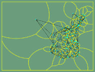
OGNITIVE SCIENCE.
A significant branch of geographic information science is concerned with how people think about their geographic surroundings. Researchers use this knowledge to make Geographic Information Systems easier to use and to improve the design of navigation systems for vehicles and for the visually impaired.
 OMPUTER SCIENCE.
The need for better methods of representing geographic information in databases and processing it for specific purposes has led to specialization in such areas as spatial databases, computational geometry, spatial reasoning, and digital libraries.
 NGINEERING and
LAND SURVEYING
are the determination and physical protraction of land boundaries to serve as a basis of real estate and taxation.
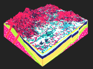
 NVIRONMENTAL SCIENCES,
which include disciplines such as Forestry and Soil Science, are advancing research into the spatio - temporal relationships of phenomena in the natural and human - modified environment, the correlation and distribution of physical and biotic resources, and the simulation of trends and conditions under varying assumptions of environmental process.
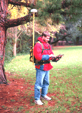
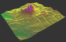
 EODETIC SCIENCE
researches new and more accurate methods for determining precise positions on the Earth's surface. GPS units, for instance, can establish their exact position anywhere on the earth by observing the signals of satellites.
 EOGRAPHY
research focuses on the development and application of geographic information theory and technologies to the discipline's traditional goal of understanding the spatial relationships between environment and society.
 ANDSCAPE ARCHITECTURE.
GIS technologies are aiding the design process as landscape architects address ecological issues and the physical, biological and social characteristics of their sites.
AW and PUBLIC POLICY
research addresses ownership rights in digital spatial data, liability associated with the creation and use of geographic information, ethical use of geographic databases, access to the government's geographic data and records, and the effects of detailed spatial data sets on personal privacy.
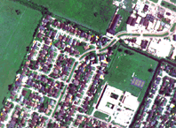
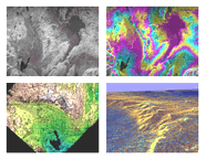
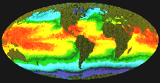
 EMOTE SENSING and
PHOTOGRAMMETRY
focus on the science of interpretation and making measurements using images acquired from a distance. These disciplines are devising new computer-based methods for detecting features, establishing their precise position, and undertaking analysis and interpretation of image content.
 TATISTICS.
Questions about the accuracy of geographic information and the uncertainties associated with coarse-scale maps are being tackled through developments in the recognized sub-fields of spatial statistics and geostatistics.
Last updated on June 1, 1997.