| |

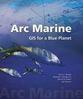
 Cover of Arc Marine book
 Click image to enlarge Click image to enlarge
|
|
 | |
Reference Book
Wright, D.J., Blongewicz, M.J., Halpin, P.N. and Breman, J., 2007. Arc Marine: GIS for a Blue Planet, Redlands, CA: ESRI Press, 202 pp. ISBN 978-1-58948-017-9
At a time when the health of our oceans is seen as crucial to our very
existence, marine researchers have developed a data model that supports
seafloor mapping, fisheries management, marine mammal tracking, monitoring of
shoreline change, and water temperature analysis. Our ability to measure
change in oceans and along coasts has increased as marine GIS has grown more
complex. Arc Marine: GIS for a Blue Planet presents the initial results
of a successful effort to create and define a data model for the marine
community—that group of academic, government, military, and private
oceanographers, resource managers, conservationists, geographers,
nautical archaeologists and others who support better management of complex
spatial analysis in marine applications. The data model not only provides
structure to storing and analyzing marine data but helps users create maps and
3-dimensional scenes of the marine environment in ways invaluable to decision
making. The standards and best practices that emerged from the case studies
in Arc Marine: GIS for a Blue Planet help form a diverse set of resources to draw from as the
marine community strives to understand, illuminate, chart, and explore the
unknown depths. As a teaching tool, Arc Marine: GIS for a Blue Planet serves as a perfect
starting point for the intermediate student or as a resource for the expert in
marine GIS and its implementation.
Foreword by Jane Lubchenco,
OSU Distinguished Professor of Marine Biology and Zoology; Member of Pew Oceans Commission and Joint Oceans Commission Initiative, and current administrator of NOAA
ESRI UC Authors' Panel PPT (13.2 Mb)
Common Marine Data Types Diagram
USGS Seafloor Mapping Case Study
ESRI UC Panel PPT (6.6 Mb)
Photoscience/USGS Louisiana Coastal Subsidence/Sea-Level Rise Case Study
Duke U. Marine Animal (Whale/Turtle/Seal) Case Studies {5}
ESRI UC Panel PPT (16.5 Mb)
Related Tools: Contact Ei Fujioka for Scripts and Tools Mentioned in Chapter
See also Duke's Marine Geospatial Ecology Tools Site
Related 2007 Case Study: Tracking the Great Whales (Oregon State U.)
Marine Institute (IRELAND) Case Study
ERRATUM: Figure 5.9 on page 94 is incorrect. Here is the correct Figure 5.9.
The caption in the book is correct as printed.
Related Tools: DHI release of
MIKE Marine GIS | Release Notes | Other
Oregon State U./Hawai'i Natural Heritage Program Reef Fish Case Study
National Park Service Hawaiian Coral Reef Monitoring Case Study
Photoscience/Martin County Florida Coastal Planning Case Study
DHI Sediment Transport/Shoreline Evolution (DENMARK)
Case Study
ESRI UC Panel PPT (6.6 Mb)
Federal Maritime and Hydrographic Agency (GERMANY) Case Study
ESRI UC Panel PPT (6.6 Mb)
Related Tools: 2.5-D Interpolator Tool for ArcGIS 9.x (rt-click, Save As, 120 Kb)
Tips on using the tool (236 Kb, PDF) | Contact the developer Morakot Pilouk
Example mdb, sxd, and related raster surfaces using tool
(rt-click, Save As, 14 Mb zip)
Tips on Calculating Volumes using an ArcGIS Approach
Geodatabase Tips & Tricks (thanks to Katsura Iizuka)
Last update: September 4, 2014
© 2001-present, D. Wright and OSU Webworks
http://dusk.geo.orst.edu/djl/arcgis/book.html
|
| |
|
 Cover of Arc Marine book
 Cover of Arc Marine book