Last update: June 22, 2011

Home
Where is American Samoa?
About FBNMS
FBNMS Main Site
AS GIS User Group
Photo Gallery
Pago Pago
Survey Preps
Fagatele Bay and Leone
Photography by Brian
SSE Mission, '02
Nov '02 Surveys
HURL Sub Dives, '05
2001 Rebreather Dives
2005 Submersible Dives
GIS Tools
2001 SSE Virtual Workshop
2003 CEO Virtual Workshop
2004 ASCC Workshop
Publications
FBNMS GIS Handbook (pdf)
Related Links
Contact the Web Goddess


Photos From Around Tutuila
Courtesy of Brian Donahue

Click on each image to view it at a MUCH larger size.
A new, adjacent window will open once for this purpose.


back to top


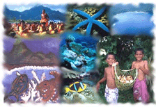
Photo montage in header courtesy of National Marine Sanctuary System and Kip Evans, National Geographic Society
http://dusk.geo.orst.edu/djl/samoa/g4.html